2009
SH6582 : Eastern end of Ynys Seiriol / Puffin Island
taken 15 years ago, 3 km from Penmon, Isle of Anglesey/Sir Ynys Mon, Wales
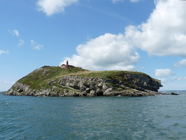
Eastern end of Ynys Seiriol / Puffin Island
Showing the disused telegraph station which was one of a chain of eleven semaphore stations from Holyhead to Liverpool.
In the early 19th century messages about ships sighted off Holyhead could be sent to Liverpool Docks in a few minutes.
The semaphore system was replaced by an electric telegraph system in 1861.
In the early 19th century messages about ships sighted off Holyhead could be sent to Liverpool Docks in a few minutes.
The semaphore system was replaced by an electric telegraph system in 1861.
 Map © Crown Copyright")
TIP: Click the map for more Large scale mapping
- Grid Square
- SH6582, 19 images (more nearby 🔍)
- Photographer
- Robin Drayton (more nearby)
- Date Taken
- Saturday, 22 August, 2009 (more nearby)
- Submitted
- Monday, 31 August, 2009
- Subject Location
-
OSGB36:
 SH 655 823 [100m precision]
WGS84: 53:19.2616N 4:1.2415W - Camera Location
-
OSGB36: SH 657 826
- View Direction
- Southwest (about 225 degrees)