2006
SO5472 : Ledwyche, Caynham
taken 18 years ago, near to Caynham, Shropshire, England
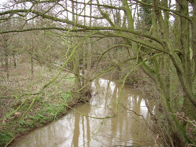
Ledwyche, Caynham
The Ledwyche Brook, looking downstream. Once it featured in a geography O level question - as a problem solving question. It joins the Teme at a funny angle, as the Teme once flowed in the opposite direction. The Ledwyche Brook drains the west side of the Clee Hills.
 Map © Crown Copyright")
TIP: Click the map for more Large scale mapping
- Grid Square
- SO5472, 6 images (more nearby 🔍)
- Photographer
- Richard Webb (more nearby)
- Date Taken
- Saturday, 1 April, 2006 (more nearby)
- Submitted
- Wednesday, 5 April, 2006
- Subject Location
-
OSGB36:
 SO 5426 7289 [10m precision]
WGS84: 52:21.1294N 2:40.3778W - Camera Location
-
OSGB36: SO 5426 7293
- View Direction
- SOUTH (about 180 degrees)