2006
SJ6879 : The Pinfold, Bate Heath
taken 18 years ago, near to Bate Heath, Cheshire East, England
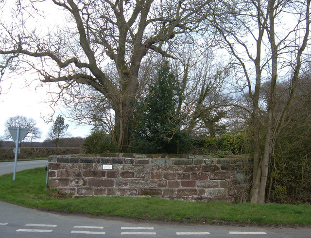
The Pinfold, Bate Heath
Situated at the junction of Budworth Road and Cann Lane. This stone structure is an 18th-century enclosure used as a pound to secure livestock.
 Map © Crown Copyright")
TIP: Click the map for more Large scale mapping
- Grid Square
- SJ6879, 10 images (more nearby 🔍)
- Photographer
- michael ely (more nearby)
- Date Taken
- Thursday, 6 April, 2006 (more nearby)
- Submitted
- Thursday, 6 April, 2006
- Subject Location
-
OSGB36:
 SJ 687 793 [100m precision]
WGS84: 53:18.5824N 2:28.2728W