2009
SZ3394 : The Lymington River
taken 15 years ago, near to Lymington, Hampshire, England
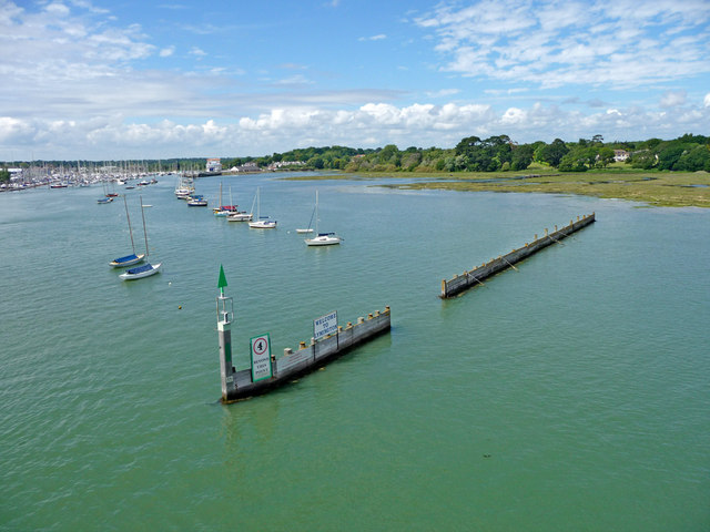
The Lymington River
Taken from the ferry shortly after passing the Marina. Lisle Court Farm can be seen in the distance and the ferry terminal is also in the distance to the left.
 Map © Crown Copyright")
TIP: Click the map for more Large scale mapping
- Grid Square
- SZ3394, 219 images (more nearby 🔍)
- Photographer
- Christine Matthews (more nearby)
- Date Taken
- Saturday, 13 June, 2009 (more nearby)
- Submitted
- Monday, 7 September, 2009
- Subject Location
-
OSGB36:
 SZ 337 948 [100m precision]
WGS84: 50:45.1473N 1:31.3850W - Camera Location
-
OSGB36: SZ 337 947
- View Direction
- NORTH (about 0 degrees)