2009
NS0175 : Canoeing through the Burnt Islands
taken 15 years ago, near to Colintraive, Argyll And Bute, Scotland
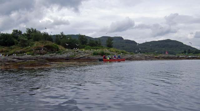
Canoeing through the Burnt Islands
It was nesting season and the Gulls were very noisy!
 Map © Crown Copyright")
TIP: Click the map for more Large scale mapping
- Grid Square
- NS0175, 31 images (more nearby 🔍)
- Photographer
- Nick Ray (more nearby)
- Date Taken
- Monday, 6 July, 2009 (more nearby)
- Submitted
- Tuesday, 8 September, 2009
- Subject Location
-
OSGB36:
 NS 018 750 [100m precision]
WGS84: 55:55.6536N 5:10.4253W - Camera Location
-
OSGB36: NS 018 751
- View Direction
- South-southwest (about 202 degrees)