2006
SJ6379 : Frandley, Cheshire
taken 18 years ago, near to Antrobus, Cheshire West And Chester, England
This is 1 of 2 images, with title starting with Frandley in this square
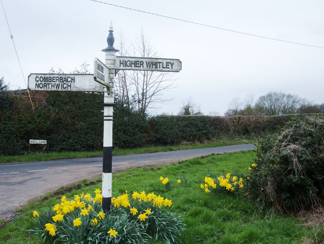
Frandley, Cheshire
A finger post in the centre of this lovely Cheshire village. Only a stone's throw from the A559. Situated at the junction of Well Lane and Wheatsheaf Lane.
 Map © Crown Copyright")
TIP: Click the map for more Large scale mapping
- Grid Square
- SJ6379, 13 images (more nearby 🔍)
- Photographer
- michael ely (more nearby)
- Date Taken
- Thursday, 6 April, 2006 (more nearby)
- Submitted
- Thursday, 6 April, 2006
- Subject Location
-
OSGB36:
 SJ 636 794 [100m precision]
WGS84: 53:18.6167N 2:32.8657W