2009
SD7477 : Southerscales
taken 15 years ago, near to Chapel-le-Dale, North Yorkshire, England
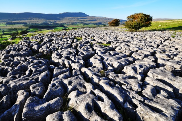
Southerscales
Limestone pavement, beneath Ingleborough, with Whernside in the distance.
From Wikipedia:
"A limestone pavement is a natural karst landform consisting of a flat, incised surface of exposed limestone that resembles an artificial pavement.
Conditions for limestone pavements are created when an advancing glacier scrapes away overburden and exposes horizontally-bedded limestone, with subsequent glacial retreat leaving behind a flat, bare surface. Limestone is slightly soluble in water, so corrosive drainage along joints and cracks in the limestone can produce slabs called "clints" isolated by deep fissures called "grikes" or "grykes", terms derived from the North of England dialect. If the grikes are fairly straight and the clints are uniform in size, the resemblance to man-made paving stones is striking, but often they are less regular. Limestone pavements that develop beneath a mantle of topsoil usually exhibit more rounded forms.
Limestone pavements can be found in many previously-glaciated limestone environments around the world. Notable examples are found in the Yorkshire Dales in Northern England, such as those above Malham Cove and on the side of Ingleborough. They are also found in the Stora Alvaret in Öland, Sweden; in the Burren, County Clare, Ireland and in the Désert de Platé in the French Alps."
 Map © Crown Copyright")
TIP: Click the map for more Large scale mapping
- Grid Square
- SD7477, 79 images (more nearby 🔍)
- Photographer
- Mike Green (more nearby)
- Date Taken
- Saturday, 12 September, 2009 (more nearby)
- Submitted
- Sunday, 13 September, 2009
- Subject Location
-
OSGB36:
 SD 748 776 [100m precision]
WGS84: 54:11.6124N 2:23.1990W - Camera Location
-
OSGB36: SD 748 774
- View Direction
- NORTH (about 0 degrees)