2009
TR0955 : Footbridge near Chartham Corn Mill
taken 15 years ago, near to Shalmsford Street, Kent, England
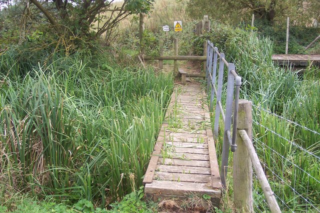
Footbridge near Chartham Corn Mill
This bridge is on a footpath from the A28 Ashford Road to Shalmsford Street.
It passes over a stream running parallel to the River Great Stour which leads past the watermill.
It passes over a stream running parallel to the River Great Stour which leads past the watermill.
 Map © Crown Copyright")
TIP: Click the map for more Large scale mapping
- Grid Square
- TR0955, 45 images (more nearby 🔍)
- Photographer
- David Anstiss (more nearby)
- Date Taken
- Sunday, 13 September, 2009 (more nearby)
- Submitted
- Wednesday, 16 September, 2009
- Subject Location
-
OSGB36:
 TR 097 553 [100m precision]
WGS84: 51:15.4962N 1:0.2667E - Camera Location
-
OSGB36: TR 097 553
- View Direction
- SOUTH (about 180 degrees)