2008
TR2068 : Hillborough Caravan Site today
taken 15 years ago, near to Hillborough, Kent, England
Hillborough Caravan Site today
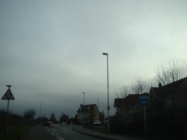
This is what Hillborough Caravan Site looks like today - a housing development with a new roundabout on Reculver Road. It is almost unrecognizable from when my family and I used to spend our summer holidays here from the 70s right through to the 90s. The access road to the site is now a council-owned road called Sanderling Road and has several cul-de-sacs leading off it, whereas of course when the caravan site was opened it was simply a privately owned road and lead to a circular road surrounded by the caravans. The caravan site closed in 1998, probably because of lack of economy, as caravanning as a holiday activity has declined rapidly. I reckon even today it would've had problems in surviving, as I don't think many people could afford the rent for caravanning in these times of the credit crunch. View taken looking south-southeast towards Hillborough.
 Map © Crown Copyright")
TIP: Click the map for more Large scale mapping
- Grid Square
- TR2068, 81 images (more nearby 🔍)
- Photographer
- Robert Lamb (more nearby)
- Date Taken
- Sunday, 14 December, 2008 (more nearby)
- Submitted
- Sunday, 20 September, 2009
- Subject Location
-
OSGB36:
 TR 207 681 [100m precision]
WGS84: 51:22.1806N 1:10.1710E - Camera Location
-
OSGB36: TR 206 682
- View Direction
- East-southeast (about 112 degrees)