2009
TA0723 : Marsh Lane, New Holland
taken 15 years ago, near to New Holland, North Lincolnshire, England
This is 1 of 4 images, with title Marsh Lane, New Holland in this square
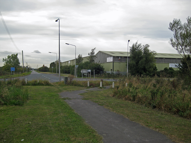
Marsh Lane, New Holland
Marsh Lane was once a direct route from Barrow Haven to New Holland. When Lincoln Castle Way (B1206) was constructed as a by-pass for New Holland it cut across this old route which is now blocked-off at this point. Straight ahead is the road to Barrow Haven.
 Map © Crown Copyright")
TIP: Click the map for more Large scale mapping
- Grid Square
- TA0723, 91 images (more nearby 🔍)
- Photographer
- David Wright (more nearby)
- Date Taken
- Monday, 21 September, 2009 (more nearby)
- Submitted
- Monday, 21 September, 2009
- Subject Location
-
OSGB36:
 TA 078 233 [100m precision]
WGS84: 53:41.7282N 0:22.1095W - Camera Location
-
OSGB36: TA 079 233
- View Direction
- WEST (about 270 degrees)