2009
SZ0991 : The Old Fire Station, Holdenhurst Road
taken 15 years ago, near to Bournemouth, Bournemouth, Christchurch & Poole, England
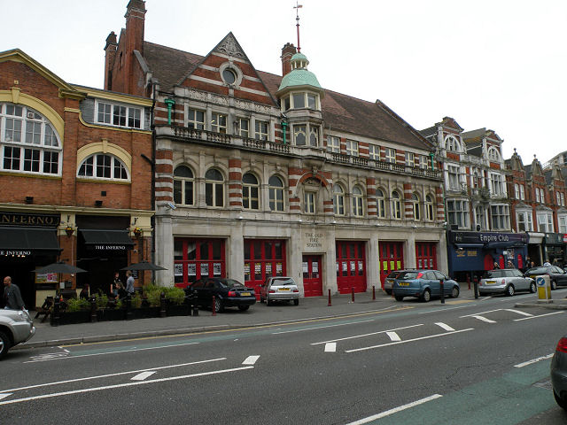
The Old Fire Station, Holdenhurst Road
Now an entertainment venue associated with Bournemouth Students' Union
 Map © Crown Copyright")
TIP: Click the map for more Large scale mapping
- Grid Square
- SZ0991, 855 images (more nearby 🔍)
- Photographer
- Keith Edkins (more nearby)
- Date Taken
- Friday, 18 September, 2009 (more nearby)
- Submitted
- Thursday, 24 September, 2009
- Subject Location
-
OSGB36:
 SZ 0962 9151 [10m precision]
WGS84: 50:43.3881N 1:51.9049W - Camera Location
-
OSGB36: SZ 0962 9153
- View Direction
- SOUTH (about 180 degrees)