2009
NT9728 : Valley north-east of Humbleton Hill
taken 15 years ago, near to Humbleton, Northumberland, England
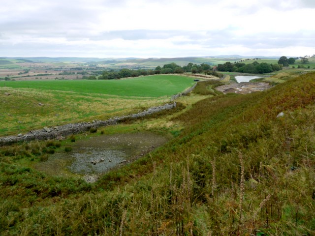
Valley north-east of Humbleton Hill
This boggy, shallow valley is part of the source of the water channel for the Humbleton millpond visible in the distance NT9728 : Small dam above Humbleton. The water was led from the upper parts of a stream on the north-west side of Humbleton Hill, above Harehope Plantation. The 1860s OS map shows that the water visible in this photograph was the original millpond which supplied a watermill situated to the west of the village. A second millpond (seasonally dry in this photograph), this side of the current water body, appears on the 1890s map and has now replaced the original one on current maps.
 Map © Crown Copyright")
TIP: Click the map for more Large scale mapping
- Grid Square
- NT9728, 39 images (more nearby 🔍)
- Photographer
- Andrew Curtis (more nearby)
- Date Taken
- Friday, 25 September, 2009 (more nearby)
- Submitted
- Saturday, 26 September, 2009
- Subject Location
-
OSGB36:
 NT 970 285 [100m precision]
WGS84: 55:33.0492N 2:2.8704W - Camera Location
-
OSGB36: NT 970 285
- View Direction
- East-southeast (about 112 degrees)