2009
NT9328 : Tom Tallon's Crag
taken 15 years ago, 3 km from Kirknewton, Northumberland, England
This is 1 of 7 images, with title Tom Tallon's Crag in this square
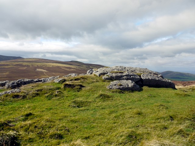
Tom Tallon's Crag
The hills to the left of the outcrop are Wester Tor and Easter Tor that make up Newton Tors.
The name of the crag probably comes from a large Bronze Age burial cairn known as Tom Tallon's Grave located about 100m to the south-west of the crag which was destroyed in 1858 Link (Archive Link )
The Ordnace Survey Name Book entry (1860) for Tom Tallon's Crag reads:
"There is a vague tradition about Tom Tallon having been a Warrior and Slain here - hence the name, but nothing authentic respecting Tom, can now be ascertained."
The name of the crag probably comes from a large Bronze Age burial cairn known as Tom Tallon's Grave located about 100m to the south-west of the crag which was destroyed in 1858 Link
The Ordnace Survey Name Book entry (1860) for Tom Tallon's Crag reads:
"There is a vague tradition about Tom Tallon having been a Warrior and Slain here - hence the name, but nothing authentic respecting Tom, can now be ascertained."
 Map © Crown Copyright")
TIP: Click the map for more Large scale mapping
- Grid Square
- NT9328, 18 images (more nearby 🔍)
- Photographer
- Andrew Curtis (more nearby)
- Date Taken
- Friday, 25 September, 2009 (more nearby)
- Submitted
- Sunday, 27 September, 2009
- Subject Location
-
OSGB36:
 NT 933 280 [100m precision]
WGS84: 55:32.7828N 2:6.4645W - Camera Location
-
OSGB36: NT 933 280
- View Direction
- WEST (about 270 degrees)