2006
TQ4214 : Barcombe Mills Station
taken 18 years ago, near to Barcombe, East Sussex, England
This is 1 of 4 images, with title Barcombe Mills Station in this square
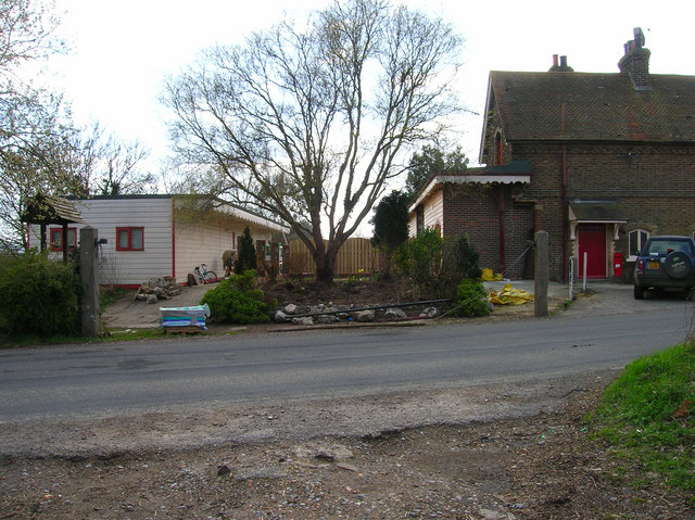
Barcombe Mills Station
The chalet to the left was the platform shelter. The station was closed with the line in 1969 even though it had always been very popular with anglers. Taken from the other side of the former level crossing.
 Map © Crown Copyright")
TIP: Click the map for more Large scale mapping
- Grid Square
- TQ4214, 75 images (more nearby 🔍)
- Photographer
- Simon Carey (more nearby)
- Date Taken
- Wednesday, 12 April, 2006 (more nearby)
- Submitted
- Thursday, 13 April, 2006
- Subject Location
-
OSGB36:
 TQ 429 149 [100m precision]
WGS84: 50:54.9527N 0:1.8886E - Camera Location
-
OSGB36: TQ 429 149
- View Direction
- Southwest (about 225 degrees)