2009
NG5729 : Rubha an h-Aird Dhuirche
taken 15 years ago, near to Luib, Isle of Skye, Scotland
This is 1 of 2 images, with title Rubha an h-Aird Dhuirche in this square
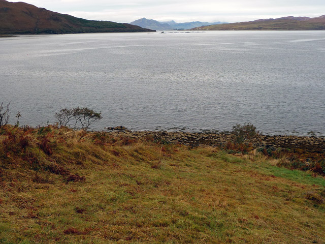
Rubha an h-Aird Dhuirche
The extremity of the point in the foreground, with a view up the Sound of Raasay towards the hills of Trotternish.
 Map © Crown Copyright")
TIP: Click the map for more Large scale mapping
- Grid Square
- NG5729, 3 images (more nearby 🔍)
- Photographer
- John Allan (more nearby)
- Date Taken
- Tuesday, 29 September, 2009 (more nearby)
- Submitted
- Tuesday, 29 September, 2009
- Subject Location
-
OSGB36:
 NG 576 290 [100m precision]
WGS84: 57:17.2579N 6:1.4344W - Camera Location
-
OSGB36: NG 576 290
- View Direction
- North-northwest (about 337 degrees)