2009
NC3451 : Strath Dionard
taken 15 years ago, 5 km SW of Polla, Highland, Scotland
This is 1 of 2 images, with title Strath Dionard in this square
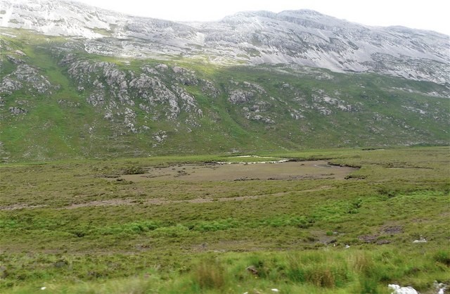
Strath Dionard
The land falls sharply from the track to the floor of the glen. The bare patch down by the river was until recently a lochan but the peat between it and the river gave way resulting in the draining of the lochan. It is still shown as a water feature on the 1:25 000 map although the 1:50 000 has it updated. The appropriate Google Earth view shows it well, including recent work to try to prevent further erosion at the river bend.
 Map © Crown Copyright")
TIP: Click the map for more Large scale mapping
- Grid Square
- NC3451, 4 images (more nearby 🔍)
- Photographer
- AlastairG (more nearby)
- Date Taken
- Saturday, 4 July, 2009 (more nearby)
- Submitted
- Thursday, 1 October, 2009
- Subject Location
-
OSGB36:
 NC 349 515 [100m precision]
WGS84: 58:25.2566N 4:49.6700W - Camera Location
-
OSGB36: NC 349 515
- View Direction
- EAST (about 90 degrees)