2009
SK0372 : Burbage and Buxton
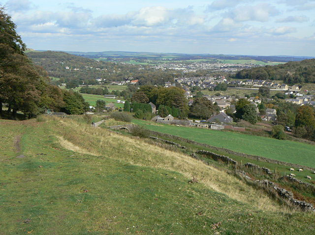
taken 15 years ago, near to Burbage, Derbyshire, England
This is 1 of 4 images, with title starting with Burbage in this square
Burbage and Buxton
From the path from Burbage up onto Burbage edge. At this point is appears to be following the earliest alignment of the road over to Macclesfield. The next stage can be seen just down the slope at the right, with sheep grazing on the line of the old railway.
 Map © Crown Copyright")
TIP: Click the map for more Large scale mapping
- Grid Square
- SK0372, 53 images (more nearby 🔍)
- Photographer
- Alan Murray-Rust (more nearby)
- Date Taken
- Thursday, 1 October, 2009 (more nearby)
- Submitted
- Sunday, 4 October, 2009
- Subject Location
-
OSGB36:
 SK 038 724 [100m precision]
WGS84: 53:14.9378N 1:56.6706W - Camera Location
-
OSGB36: SK 033 722
- View Direction
- East-northeast (about 67 degrees)