2009
SE7188 : Rolling countryside
taken 15 years ago, near to Hutton-le-Hole, North Yorkshire, England
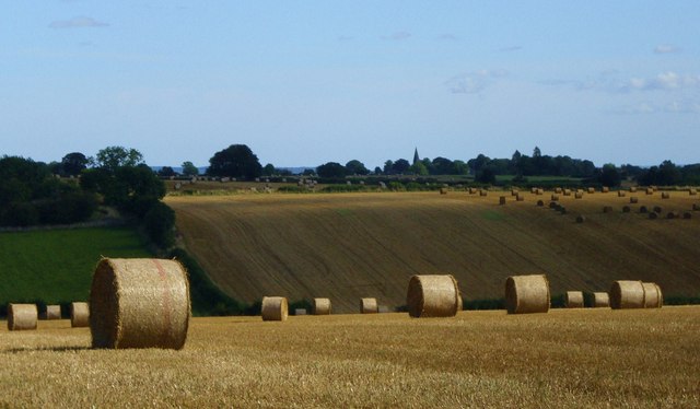
Rolling countryside
Straw rolls on the Tabular Hills near Hutton le Hole. The spire of Appleton le Moors church can be seen in the distance.
 Map © Crown Copyright")
TIP: Click the map for more Large scale mapping
- Grid Square
- SE7188, 38 images (more nearby 🔍)
- Photographer
- Gordon Hatton (more nearby)
- Date Taken
- Sunday, 20 September, 2009 (more nearby)
- Submitted
- Tuesday, 6 October, 2009
- Subject Location
-
OSGB36:
 SE 715 888 [100m precision]
WGS84: 54:17.4004N 0:54.1391W - Camera Location
-
OSGB36: SE 713 888
- View Direction
- East-southeast (about 112 degrees)