2006
SN8272 : Peat hags between Geifas and Fagwyr Wen
taken 18 years ago, 4 km ESE of Cwmystwyth, Ceredigion/Sir Ceredigion, Wales
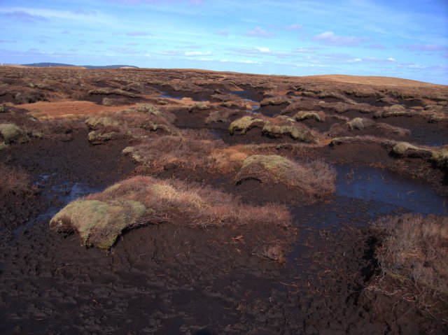
Peat hags between Geifas and Fagwyr Wen
This square is rather flat around the 540m level. It is mostly peat bog with streams draining north, south and east. While the dips are covered with tall grass and sphagnum, the higher areas have peat hags with deep channels in between. Very difficult terrain to navigate through!
 Map © Crown Copyright")
TIP: Click the map for more Large scale mapping
- Grid Square
- SN8272, 3 images (more nearby 🔍)
- Photographer
- Rudi Winter (more nearby)
- Date Taken
- Friday, 14 April, 2006 (more nearby)
- Submitted
- Saturday, 15 April, 2006
- Subject Location
-
OSGB36:
 SN 824 729 [100m precision]
WGS84: 52:20.4918N 3:43.6578W - Camera Location
-
OSGB36: SN 824 729
- View Direction
- Northwest (about 315 degrees)