2009
NY4601 : Spoil Heap
taken 15 years ago, 3 km from Kentmere, Cumbria, England
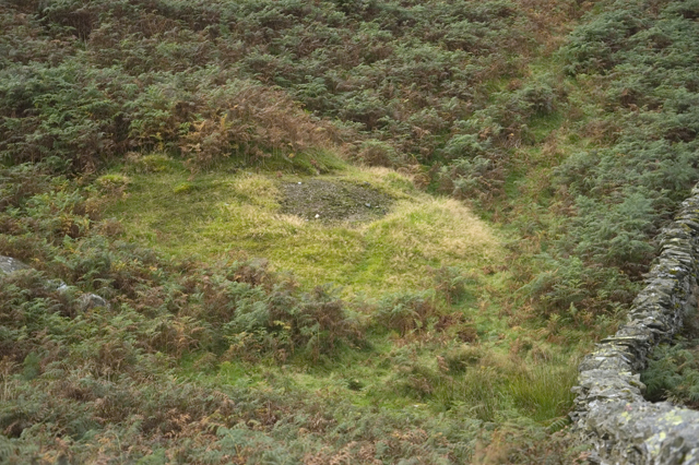
Spoil Heap
The only visible signs of Upper Staveley Lead Mine. Records of intermittent mining here begin in 1676 and end in 1895
 Map © Crown Copyright")
TIP: Click the map for more Large scale mapping
- Grid Square
- NY4601, 11 images (more nearby 🔍)
- Photographer
- Tom Richardson (more nearby)
- Date Taken
- Monday, 5 October, 2009 (more nearby)
- Submitted
- Thursday, 8 October, 2009
- Subject Location
-
OSGB36:
 NY 465 015 [100m precision]
WGS84: 54:24.3679N 2:49.5335W - Camera Location
-
OSGB36: NY 464 015
- View Direction
- Southeast (about 135 degrees)