2009
NX1185 : Duniewick from Knockdolian
taken 15 years ago, near to Knockdolian, South Ayrshire, Scotland
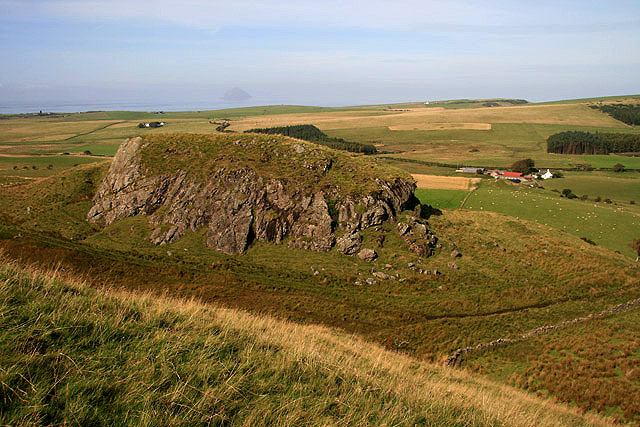
Duniewick from Knockdolian
There is a hill fort on this outcrop on the northeast side of Kockdolian. Bougang Farm is in the background to the right and a faint Ailsa Craig in the Firth of Clyde can be made out directly beyond Duniewick.
 Map © Crown Copyright")
TIP: Click the map for more Large scale mapping
- Grid Square
- NX1185, 51 images (more nearby 🔍)
- Photographer
- Walter Baxter (more nearby)
- Date Taken
- Friday, 11 September, 2009 (more nearby)
- Submitted
- Saturday, 10 October, 2009
- Subject Location
-
OSGB36:
 NX 1163 8516 [10m precision]
WGS84: 55:7.4944N 4:57.3490W - Camera Location
-
OSGB36: NX 1172 8504
- View Direction
- Northwest (about 315 degrees)