2009
SY5584 : Abbotsbury, waymarker
taken 15 years ago, near to Abbotsbury, Dorset, England
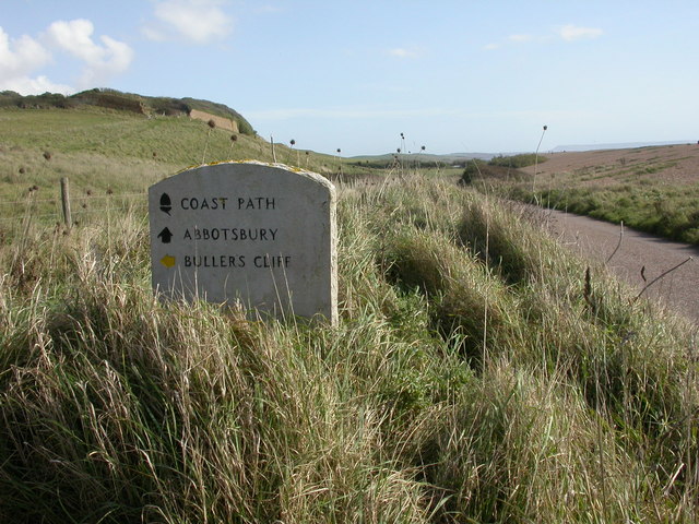
Abbotsbury, waymarker
Stone waymarker on the South West Coast Path; Buller's Cliff in the background, to the left, Chesil Bank to the right.
 Map © Crown Copyright")
TIP: Click the map for more Large scale mapping
- Grid Square
- SY5584, 54 images (more nearby 🔍)
- Photographer
- Mike Faherty (more nearby)
- Date Taken
- Saturday, 10 October, 2009 (more nearby)
- Submitted
- Saturday, 10 October, 2009
- Subject Location
-
OSGB36:
 SY 5565 8482 [10m precision]
WGS84: 50:39.6813N 2:37.7298W - Camera Location
-
OSGB36: SY 5565 8482
- View Direction
- Southeast (about 135 degrees)