2009
SM8024 : Circular walk from Solva to St Elvis and Dinas Fawr (4)
taken 15 years ago, near to Solva, Pembrokeshire/Sir Benfro, Wales
Circular walk from Solva to St Elvis and Dinas Fawr (4)
This series of photos portrays a 2-mile circular walk east and south of Solva, Pembrokeshire.
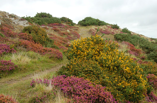
Initially, the walk climbs out of the valley of the River Solva onto The Gribbin, a knife-edge ridge between the glacial valleys of Solva and Gwadn. The walk then descends to a marshy area before climbing inland to farmland. Near St Elvis Farm, the walk passes a cromlech (a neolithic burial chamber) then heads to the coastpath and turns west to follow the clifftop. After descending into Gwadn cove, the walk climbs to rejoin The Gribbin before descending into Solva. The route can be followed on OS 1:50000 sheet 157 or on OS 'Explorer' 1:25000 sheet OL35.
The Gribbin has a moorland aspect and is studded with wildflowers throughout the year. In early autumn, as this photo shows, heather and gorse are to the fore.
Previous [Link]
Next [Link]
 Map © Crown Copyright")
TIP: Click the map for more Large scale mapping
- Grid Square
- SM8024, 346 images (more nearby 🔍)
- Photographer
- Andy F (more nearby)
- Date Taken
- Sunday, 27 September, 2009 (more nearby)
- Submitted
- Tuesday, 13 October, 2009
- Subject Location
-
OSGB36:
 SM 806 242 [100m precision]
WGS84: 51:52.4092N 5:11.2650W - Camera Location
-
OSGB36: SM 806 242
- View Direction
- Northeast (about 45 degrees)