2009
TG3100 : Bridleway to Cooke's Road
taken 15 years ago, near to Thurton, Norfolk, England
This is 1 of 2 images, with title Bridleway to Cooke's Road in this square
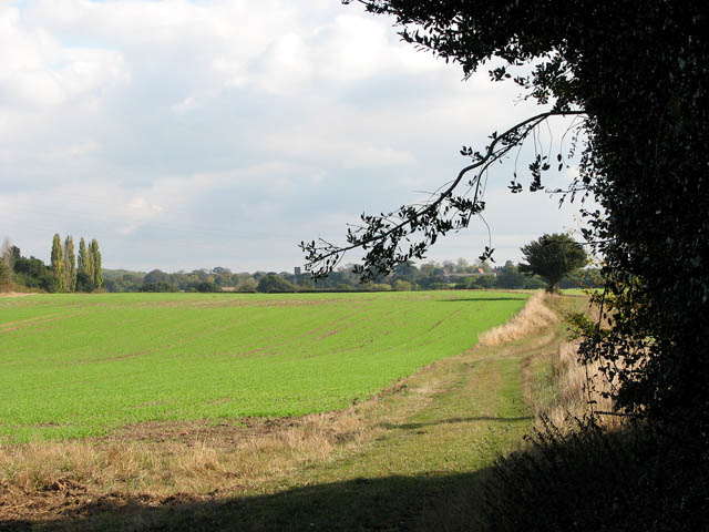
Bridleway to Cooke's Road
This public bridleway leads from Cooke's Road (turning off in southerly direction by Heath Side > Link running in westerly direction across fields > Link. It emerges on Dodgers Lane, passing Church Farm > Link and onwards to The Street from there > Link. The tower of St Ethelbert's church > Link in Thurton can be glimpsed on the horizon.
 Map © Crown Copyright")
TIP: Click the map for more Large scale mapping
- Grid Square
- TG3100, 45 images (more nearby 🔍)
- Photographer
- Evelyn Simak (more nearby)
- Date Taken
- Thursday, 15 October, 2009 (more nearby)
- Submitted
- Thursday, 15 October, 2009
- Subject Location
-
OSGB36:
 TG 319 007 [100m precision]
WGS84: 52:33.2922N 1:25.1831E - Camera Location
-
OSGB36: TG 312 008
- View Direction
- East-southeast (about 112 degrees)