2009
SU1916 : Lone tree by the B3078 road, Deadman Hill
taken 14 years ago, near to Hale, Hampshire, England
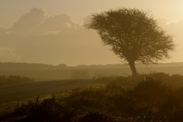
Lone tree by the B3078 road, Deadman Hill
This tree is on Deadman Hill, a gravel-topped ridge with Cunninger Bottom to the north and Stone Quarry Bottom to the south. The B3078 road bends to the left here and through a dangerous dip where cattle and ponies often congregate and deer run through from one valley to the next. On misty autumn mornings the sun rises in just the right place to dazzle drivers commuting east from Fordingbridge.
 Map © Crown Copyright")
TIP: Click the map for more Large scale mapping
- Grid Square
- SU1916, 47 images (more nearby 🔍)
- Photographer
- Jim Champion (more nearby)
- Date Taken
- Friday, 23 October, 2009 (more nearby)
- Submitted
- Saturday, 24 October, 2009
- Subject Location
-
OSGB36:
 SU 1951 1642 [10m precision]
WGS84: 50:56.8134N 1:43.4194W - Camera Location
-
OSGB36: SU 1946 1642
- View Direction
- EAST (about 90 degrees)