2009
SH7131 : The A470 at Bronaber
taken 14 years ago, near to Bronaber, Gwynedd, Wales
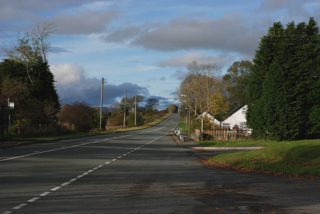
The A470 at Bronaber
Bronaber was the site of an army camp which was mainly associated with the one-time local firing ranges. A line of corrugated-iron buildings along the road, known locally as Tin-town, housed shops and other civilian facilities for the use of army personnel; some still remain, such as the white building in the photograph. The camp dated from 1906 and was extended over the years, but was less used after 1945. It finally closed as an army base in 1958, but was then re-opened to house those building the Trawsfynydd nuclear reactor and associated structures, being finally closed in 1963. Trawsfynydd Holiday Village now occupies much of the site.
 Map © Crown Copyright")
TIP: Click the map for more Large scale mapping
- Grid Square
- SH7131, 21 images (more nearby 🔍)
- Photographer
- Nigel Brown (more nearby)
- Date Taken
- Monday, 26 October, 2009 (more nearby)
- Submitted
- Monday, 26 October, 2009
- Subject Location
-
OSGB36:
 SH 712 318 [100m precision]
WGS84: 52:52.0933N 3:54.8755W - Camera Location
-
OSGB36: SH 712 317
- View Direction
- North-northwest (about 337 degrees)