2009
TM4195 : Path to Maypole Green past Toft Monks water tower
taken 14 years ago, near to Maypole Green, Norfolk, England
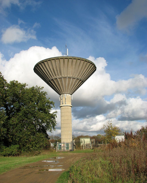
Path to Maypole Green past Toft Monks water tower
The water tower is situated beside the public footpath to Maypole Green (seen in foreground), just north of College Farm. It was constructed using a method developed in Sweden, whereby first the concrete shaft was built; then the top, an inverted cone, was constructed at ground level and jacked up into place, this taking 22 hours over three days. The shape is referred to as "wine glass" tower.
 Map © Crown Copyright")
TIP: Click the map for more Large scale mapping
- Grid Square
- TM4195, 65 images (more nearby 🔍)
- Photographer
- Evelyn Simak (more nearby)
- Date Taken
- Wednesday, 4 November, 2009 (more nearby)
- Submitted
- Wednesday, 4 November, 2009
- Subject Location
-
OSGB36:
 TM 413 951 [100m precision]
WGS84: 52:30.0220N 1:33.2324E - Camera Location
-
OSGB36: TM 412 950
- View Direction
- Northeast (about 45 degrees)