2009
NT2540 : The swollen River Tweed, Peebles
taken 14 years ago, near to Peebles, Scottish Borders, Scotland
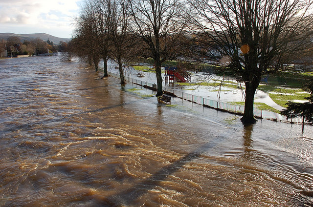
The swollen River Tweed, Peebles
Taken from the Tweed Bridge, showing the river surging through and spilling out to the low-lying land on the S side. The high ground of the Tweed's catchment to the SW will have collected plenty of rain during the 19th November.
 Map © Crown Copyright")
TIP: Click the map for more Large scale mapping
- Grid Square
- NT2540, 1180 images (more nearby 🔍)
- Photographer
- Jim Barton (more nearby)
- Date Taken
- Friday, 20 November, 2009 (more nearby)
- Submitted
- Friday, 20 November, 2009
- Subject Location
-
OSGB36:
 NT 251 402 [100m precision]
WGS84: 55:38.9785N 3:11.4289W - Camera Location
-
OSGB36: NT 250 402
- View Direction
- East-southeast (about 112 degrees)