2009
TF0198 : Caistor Canal
taken 14 years ago, near to Brandy Wharf, Lincolnshire, England
This is 1 of 2 images, with title Caistor Canal in this square
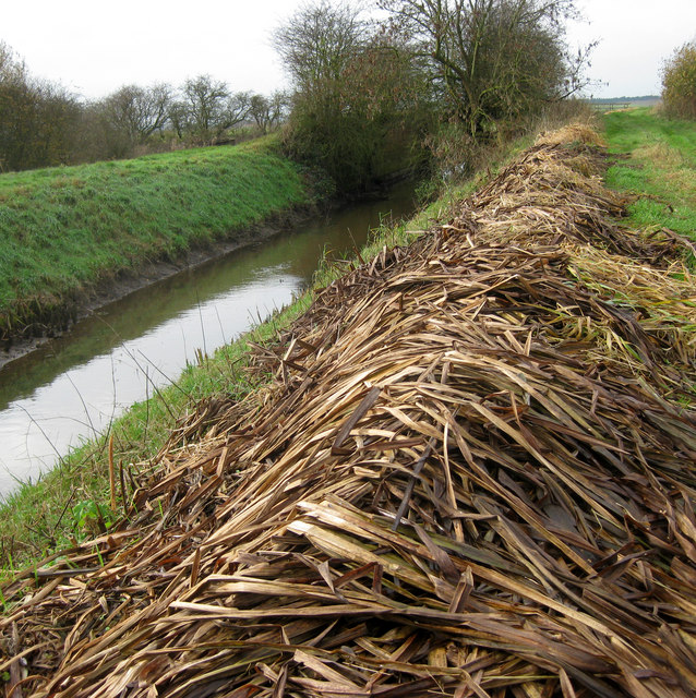
Caistor Canal
Rushes cut and cleared by the Environment Agency rot down on the bank. The bushes in the middle of the picture conceal what remains of the Beck End Lock.
 Map © Crown Copyright")
TIP: Click the map for more Large scale mapping
- Grid Square
- TF0198, 23 images (more nearby 🔍)
- Photographer
- Kate Nicol (more nearby)
- Date Taken
- Saturday, 21 November, 2009 (more nearby)
- Submitted
- Saturday, 21 November, 2009
- Subject Location
-
OSGB36:
 TF 011 989 [100m precision]
WGS84: 53:28.6594N 0:28.6421W - Camera Location
-
OSGB36: TF 012 989
- View Direction
- WEST (about 270 degrees)