2009
TQ3479 : Bell & Griffin pub (site of) Rotherhithe Street, London, SE16
taken 14 years ago, near to Stepney, Tower Hamlets, England
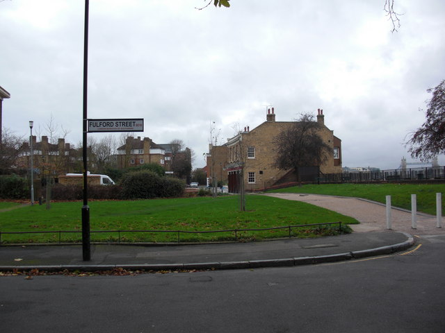
Bell & Griffin pub (site of) Rotherhithe Street, London, SE16
I do not know the number but it was at the north west corner of Fulford Street from 1752 until 1782 when it burnt down killing two people. Image is interesting as it can locate many other pubs :- where the tree branches can be seen on the right stood the 'Dover Castle' (1805-1931), building on the right is the 'Angel' (1682-current) and opposite that stood the 'Sailors Return' (1757-1831). Beyond that was the 'Black Bull' (1757-1909) followed a few yards by the 'Globe (1805-1892). The last one faced the 'Watermans Arms' (1841-1880) and between that and the Angel stood 'India House' (1805-1883). All in a distance of about 500 yards. To crown it all, within a distance of 100 yards behind the photographer stood five other pubs.
 Map © Crown Copyright")
TIP: Click the map for more Large scale mapping
- Grid Square
- TQ3479, 836 images (more nearby 🔍)
- Photographer
- Chris Lordan (more nearby)
- Date Taken
- Tuesday, 24 November, 2009 (more nearby)
- Submitted
- Sunday, 29 November, 2009
- Subject Location
-
OSGB36:
 TQ 348 797 [100m precision]
WGS84: 51:30.0262N 0:3.5432W - Camera Location
-
OSGB36: TQ 349 797
- View Direction
- WEST (about 270 degrees)