2009
SS6692 : The Tawe Barrage
taken 15 years ago, near to Swansea/Abertawe, Wales
This is 1 of 2 images, with title starting with The Tawe in this square
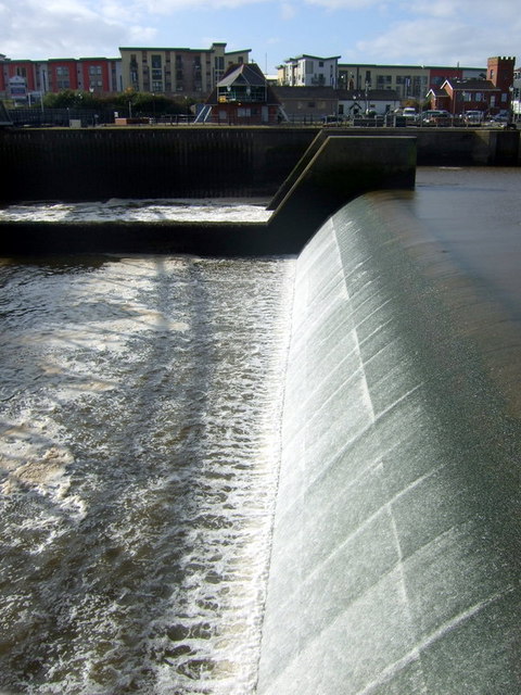
The Tawe Barrage
The barrage was constructed in 1992 to allow a mid-tidal depth within the river at all times, becoming the first tidal barrage across a river in the UK. However within two years the National Rivers Authority had found serious problems with oxygen levels in the river and ability of migratory fish, such as salmon, to find gaps in the fish pass. Improvements were needed and successful modifications to the barrage fish pass were completed in the year 2000; a system has also been developed to prevent over-salination resulting from the incursion of sea water at high tide.
 Map © Crown Copyright")
TIP: Click the map for more Large scale mapping
- Grid Square
- SS6692, 205 images (more nearby 🔍)
- Photographer
- Natasha Ceridwen de Chroustchoff (more nearby)
- Date Taken
- Wednesday, 21 October, 2009 (more nearby)
- Submitted
- Saturday, 5 December, 2009
- Subject Location
-
OSGB36:
 SS 664 926 [100m precision]
WGS84: 51:36.9802N 3:55.8202W - Camera Location
-
OSGB36: SS 664 926
- View Direction
- West-southwest (about 247 degrees)