2006
NS3681 : Entering the woods
taken 18 years ago, 3 km from Balloch, West Dunbartonshire, Scotland
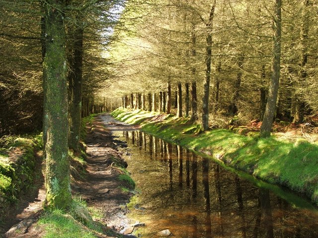
Entering the woods
The feel of this track changed dramatically when all of the trees on the right-hand side were cut down a couple of years later; compare the appearance of the same section of track in 2009: NS3681 : Gate on the Stoneymollan Road footpath (the present photo was taken from just beyond that gate).
The Stoneymollan Road
This route from Balloch to the clachan of Kirkton was an old coffin road (see Link
for more details); its destination was the burial ground at St Mahew's Chapel Link near Cardross. The eastern part of this old road lies upon one of several parallel ridges; the underlying geology must therefore have played an important role in determining its course.
 Map © Crown Copyright")
TIP: Click the map for more Large scale mapping
- Grid Square
- NS3681, 68 images (more nearby 🔍)
- Photographer
- Lairich Rig (more nearby)
- Date Taken
- Friday, 5 May, 2006 (more nearby)
- Submitted
- Tuesday, 8 December, 2009
- Subject Location
-
OSGB36:
 NS 3612 8172 [10m precision]
WGS84: 56:0.0205N 4:37.7704W - Camera Location
-
OSGB36: NS 3621 8174
- View Direction
- West-southwest (about 247 degrees)