2006
NC9048 : Documenting the demise
taken 18 years ago, 4 km S of Trantlebeg, Highland, Scotland
Documenting the demise
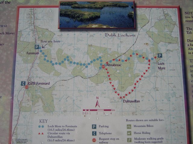
Interpretation board showing a walk across what is left of the Flow country here. The green shows the extent of 1980's tax dodge forestry. Many square kilometres of peat bog were replaced by poor quality plantations with little expectation of a decent yield of timber. It was possible to offset investment in forestry against tax, and the Flow Country was considered an ideal area with vast areas of cheap land. The loss in habitat caused more than a slight amount of protest, and celebrities often outed as being investors. Sitka and Lodgepole were commonly called "Wogan Trees". Now a lot of the green is being removed from the map, the trees being removed and the bogs restored.
The track shown goes to Loch More via the isolated Alltnabreac station.
The track shown goes to Loch More via the isolated Alltnabreac station.
 Map © Crown Copyright")
TIP: Click the map for more Large scale mapping
- Grid Square
- NC9048, 17 images (more nearby 🔍)
- Photographer
- Richard Webb (more nearby)
- Date Taken
- Tuesday, 18 April, 2006 (more nearby)
- Submitted
- Monday, 1 May, 2006
- Subject Location
-
OSGB36:
 NC 903 485 [100m precision]
WGS84: 58:24.6635N 3:52.7550W