2009
TQ4386 : Ilford Hill
taken 14 years ago, near to Ilford, Redbridge, England
Ilford Hill
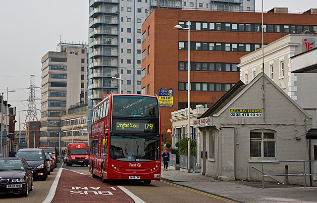
A 179 bus climbs towards the junction with Cranbrook Road and the bus stops outside Ilford Station. On the right is one of the ubiquitous minicab offices that can usually be found close to railway stations. The building looks like an ex-railway company building.
Behind are offices and flats with BT's Mill House in the background. The bridge in the distance on the left, next to the pylon, carries the A406 North Circular Road across Ilford Hill on route to its eastern terminus around 3Km south of here at the junction with the A13.
Behind are offices and flats with BT's Mill House in the background. The bridge in the distance on the left, next to the pylon, carries the A406 North Circular Road across Ilford Hill on route to its eastern terminus around 3Km south of here at the junction with the A13.
 Map © Crown Copyright")
TIP: Click the map for more Large scale mapping
- Grid Square
- TQ4386, 193 images (more nearby 🔍)
- Photographer
- Martin Addison (more nearby)
- Date Taken
- Wednesday, 16 December, 2009 (more nearby)
- Submitted
- Sunday, 20 December, 2009
- Subject Location
-
OSGB36:
 TQ 435 863 [100m precision]
WGS84: 51:33.4884N 0:4.1348E - Camera Location
-
OSGB36: TQ 435 864
- View Direction
- West-southwest (about 247 degrees)