2009
NZ3751 : Thristley House Farm (view north-east)
taken 14 years ago, near to Doxford Park, Sunderland, England
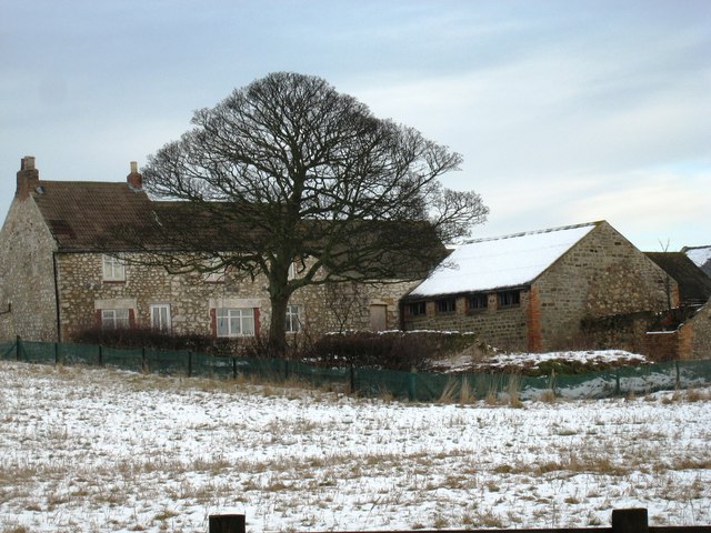
Thristley House Farm (view north-east)
This photograph of the farm was taken from a nearby lay-by on the south-bound carriageway of the A19 road looking in an north-easterly direction. The farm seems to have changed somewhat in the three years that have elapsed since this earlier photograph was taken: NZ3751 : Thristley House Farm .
 Map © Crown Copyright")
TIP: Click the map for more Large scale mapping
- Grid Square
- NZ3751, 20 images (more nearby 🔍)
- Photographer
- Philip Barker (more nearby)
- Date Taken
- Saturday, 26 December, 2009 (more nearby)
- Submitted
- Saturday, 26 December, 2009
- Subject Location
-
OSGB36:
 NZ 377 513 [100m precision]
WGS84: 54:51.3153N 1:24.7739W - Camera Location
-
OSGB36: NZ 377 512
- View Direction
- Northeast (about 45 degrees)