2006
NG6217 : Bridge on the Boreraig Track
taken 18 years ago, 3 km from Heaste, Isle of Skye, Scotland
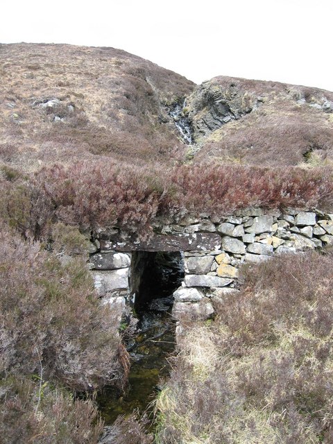
Bridge on the Boreraig Track
This bridge over a tributary of the Allt na Pairte was built by the crofters of Boreraig to support the cart track connecting their remote village to the outside world.
 Map © Crown Copyright")
TIP: Click the map for more Large scale mapping
- Grid Square
- NG6217, 12 images (more nearby 🔍)
- Photographer
- John Allan (more nearby)
- Date Taken
- Thursday, 4 May, 2006 (more nearby)
- Submitted
- Thursday, 4 May, 2006
- Subject Location
-
OSGB36:
 NG 623 173 [100m precision]
WGS84: 57:11.0821N 5:56.1116W - Camera Location
-
OSGB36: NG 624 173
- View Direction
- WEST (about 270 degrees)