2006
SZ3289 : Fort Albert
taken 18 years ago, near to Norton, Isle of Wight, England
This is 1 of 6 images, with title Fort Albert in this square
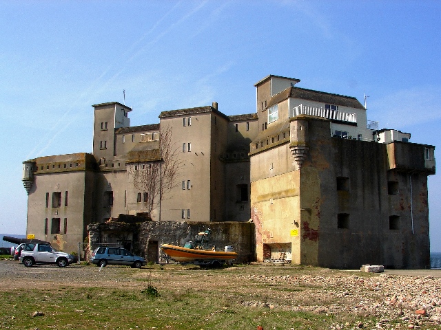
Fort Albert
The land side of Fort Albert which looks out over Hurst Channel at the western end of the Solent.
 Map © Crown Copyright")
TIP: Click the map for more Large scale mapping
- Grid Square
- SZ3289, 31 images (more nearby 🔍)
- Photographer
- Mark Pilbeam (more nearby)
- Date Taken
- Thursday, 4 May, 2006 (more nearby)
- Submitted
- Thursday, 4 May, 2006
- Subject Location
-
OSGB36:
 SZ 32 89 [1000m precision]
WGS84: 50:42.2542N 1:32.4680W - View Direction
- WEST (about 270 degrees)