2009
TR0952 : Footpath junction in Denge Wood
taken 14 years ago, near to Shalmsford Street, Kent, England
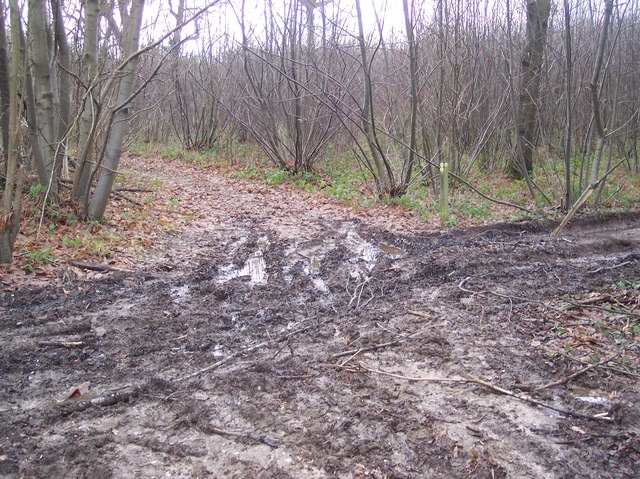
Footpath junction in Denge Wood
A footpath from Penny Pot Lane heads up through the wood, then straight on towards a bridleway heading to Upper Thruxted Farm. Also another footpath heads right to the same bridleway but heading towards Mystole Road. An access track also heads left to a coppiced area within the wood.
Denge Wood
Denge Wood is a wood located 8 miles southwest of Canterbury in Kent, England. The wood is owned by the Forestry Commission and the Woodland Trust. Part of the wood is also privately owned. Much of Denge Wood is classified as ancient semi-natural woodland suggesting it has been in existence since at least 1600AD and probably longer. See Link
for Woodland Trust website page. See also Link
for Forestry Commission website page.
 Map © Crown Copyright")
TIP: Click the map for more Large scale mapping
- Grid Square
- TR0952, 17 images (more nearby 🔍)
- Photographer
- David Anstiss (more nearby)
- Date Taken
- Monday, 28 December, 2009 (more nearby)
- Submitted
- Tuesday, 5 January, 2010
- Subject Location
-
OSGB36:
 TR 092 523 [100m precision]
WGS84: 51:13.9125N 0:59.7336E - Camera Location
-
OSGB36: TR 092 523
- View Direction
- South-southwest (about 202 degrees)