2006
SU3806 : Causeway across the carr, Beaulieu River, New Forest
taken 18 years ago, 3 km from Dibden Purlieu, Hampshire, England
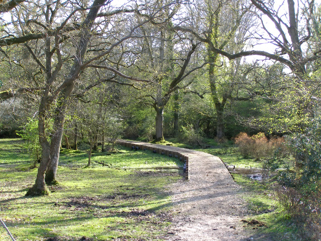
Causeway across the carr, Beaulieu River, New Forest
This recently constructed causeway makes it easier to get to the footbridge over the River Beaulieu without getting wet feet. The path continues through the belt of riverine woodland on the far bank before climbing the heathland of Buck Hill on the way to Gurnetfields Furzebrake.
 Map © Crown Copyright")
TIP: Click the map for more Large scale mapping
- Grid Square
- SU3806, 44 images (more nearby 🔍)
- Photographer
- Jim Champion (more nearby)
- Date Taken
- Monday, 1 May, 2006 (more nearby)
- Submitted
- Saturday, 6 May, 2006
- Subject Location
-
OSGB36:
 SU 380 060 [100m precision]
WGS84: 50:51.1365N 1:27.6930W - View Direction
- Southwest (about 225 degrees)