2010
SK7929 : Jubilee Way Long Distance Footpath
taken 14 years ago, near to Eaton, Leicestershire, England
This is 1 of 4 images, with title Jubilee Way Long Distance Footpath in this square
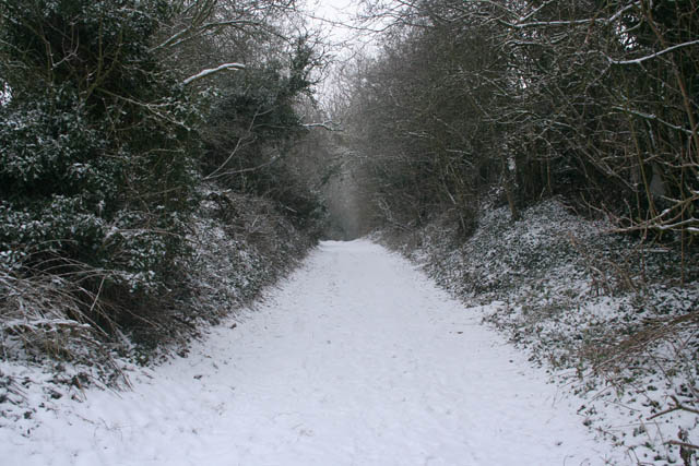
Jubilee Way Long Distance Footpath
This far track doubles up as the Jubilee Way. Usually very muddy and rutted, this track has been smoothed out by the snowfall. The high hedges either side give an air of mystery.
Eaton Community Park is behind the hedge on the left and Grantcliffe Farm is to the right.
Eaton Community Park is behind the hedge on the left and Grantcliffe Farm is to the right.
 Map © Crown Copyright")
TIP: Click the map for more Large scale mapping
- Grid Square
- SK7929, 175 images (more nearby 🔍)
- Photographer
- Kate Jewell (more nearby)
- Date Taken
- Tuesday, 5 January, 2010 (more nearby)
- Submitted
- Tuesday, 5 January, 2010
- Subject Location
-
OSGB36:
 SK 795 293 [100m precision]
WGS84: 52:51.3200N 0:49.2380W - Camera Location
-
OSGB36: SK 795 292
- View Direction
- NORTH (about 0 degrees)