2006
SX4655 : Victoria Park
taken 18 years ago, near to Plymouth, England
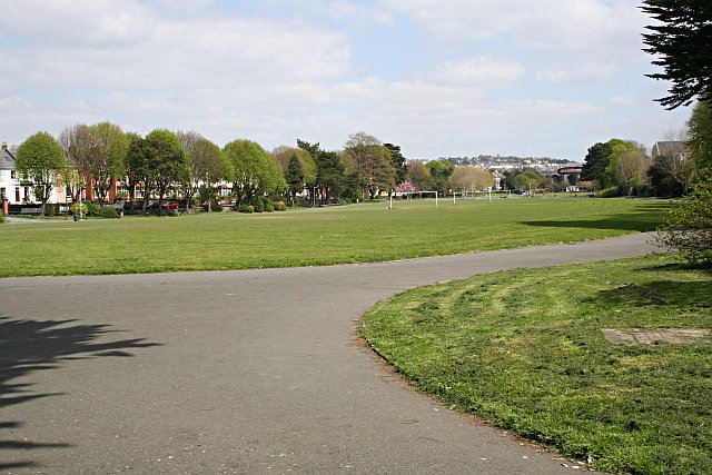
Victoria Park
This park used to be the upper part of the Stonehouse Creek tidal inlet ( SX4654 : Sunday Morning Rugby on Stonehouse Creek ). It had been used as a tidal pond to power mills situated on a bridge across the creek close by where the photographer is standing. This area of town is today known as Millbridge. By the late 19th century this part of the creek was known as deadlake and was becoming a health hazard to local residents. After the very hot summer of 1887 efforts were started to fill in the creek and it was officially opened as a park in 1902.
 Map © Crown Copyright")
TIP: Click the map for more Large scale mapping
- Grid Square
- SX4655, 157 images (more nearby 🔍)
- Photographer
- Tony Atkin (more nearby)
- Date Taken
- Friday, 28 April, 2006 (more nearby)
- Submitted
- Saturday, 6 May, 2006
- Subject Location
-
OSGB36:
 SX 467 550 [100m precision]
WGS84: 50:22.4922N 4:9.4351W - Camera Location
-
OSGB36: SX 466 549
- View Direction
- Northeast (about 45 degrees)