2010
SP1522 : Start of bridleway
taken 14 years ago, near to Upper Slaughter, Gloucestershire, England
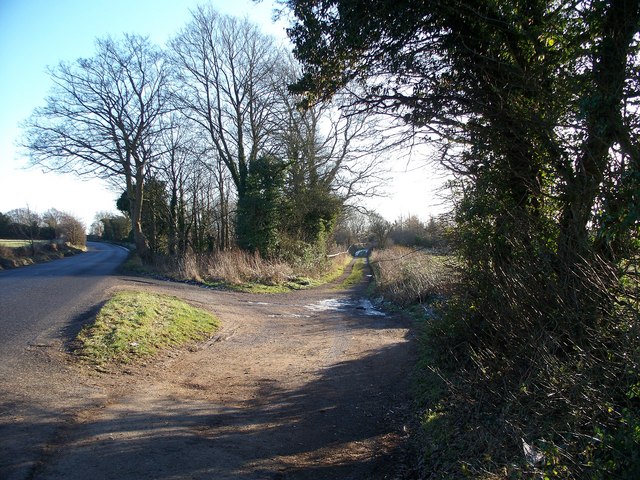
Start of bridleway
Branching off the minor road which runs from the Fosse Way A429 to the B4068 is this bridleway which runs south to meet with the Macmillan Way long distance path.
 Map © Crown Copyright")
TIP: Click the map for more Large scale mapping
- Grid Square
- SP1522, 25 images (more nearby 🔍)
- Photographer
- Michael Dibb (more nearby)
- Date Taken
- Saturday, 2 January, 2010 (more nearby)
- Submitted
- Friday, 8 January, 2010
- Subject Location
-
OSGB36:
 SP 1529 2222 [10m precision]
WGS84: 51:53.8992N 1:46.7516W - Camera Location
-
OSGB36: SP 1528 2229
- View Direction
- SOUTH (about 180 degrees)