2010
SO7640 : Lane to Underhills Farm in the snow
taken 14 years ago, near to Little Malvern, Worcestershire, England
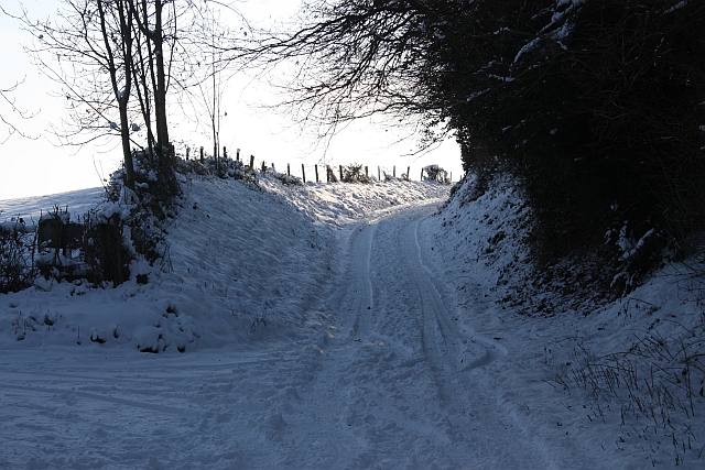
Lane to Underhills Farm in the snow
This was once the road from Little Malvern to Glorster on old maps.
Now a road only as far as the farm, but a bridleway from then onwards across Shadybank Common.
Now a road only as far as the farm, but a bridleway from then onwards across Shadybank Common.
 Map © Crown Copyright")
TIP: Click the map for more Large scale mapping
- Grid Square
- SO7640, 573 images (more nearby 🔍)
- Photographer
- Bob Embleton (more nearby)
- Date Taken
- Friday, 8 January, 2010 (more nearby)
- Submitted
- Saturday, 9 January, 2010
- Subject Location
-
OSGB36:
 SO 769 400 [100m precision]
WGS84: 52:3.4954N 2:20.2646W - Camera Location
-
OSGB36: SO 769 400
- View Direction
- South-southeast (about 157 degrees)