2010
TG2602 : The village hall in Poringland
taken 14 years ago, near to Poringland, Norfolk, England
This is 1 of 5 images, with title The village hall in Poringland in this square
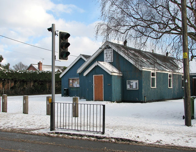
The village hall in Poringland
It is situated opposite Budgens supermarket, by the junction of The Street and The Footpath.
The land the village hall is situated on was donated to the village in 1919 by Mrs Birkbeck, who lived in The White House in Upgate. In the same year, the Trustees purchased an old army hut from Langley Park and in 1939 an extension, The Men's Club Room, was added. A tiny room at the back was used as a doctor's surgery during and after WW2.
The land the village hall is situated on was donated to the village in 1919 by Mrs Birkbeck, who lived in The White House in Upgate. In the same year, the Trustees purchased an old army hut from Langley Park and in 1939 an extension, The Men's Club Room, was added. A tiny room at the back was used as a doctor's surgery during and after WW2.
 Map © Crown Copyright")
TIP: Click the map for more Large scale mapping
- Grid Square
- TG2602, 465 images (more nearby 🔍)
- Photographer
- Evelyn Simak (more nearby)
- Date Taken
- Saturday, 9 January, 2010 (more nearby)
- Submitted
- Saturday, 9 January, 2010
- Subject Location
-
OSGB36:
 TG 268 021 [100m precision]
WGS84: 52:34.2131N 1:20.7203E - Camera Location
-
OSGB36: TG 267 021
- View Direction
- East-northeast (about 67 degrees)