2010
TM1445 : Ice bound River Gipping
taken 14 years ago, near to Chantry, Suffolk, England
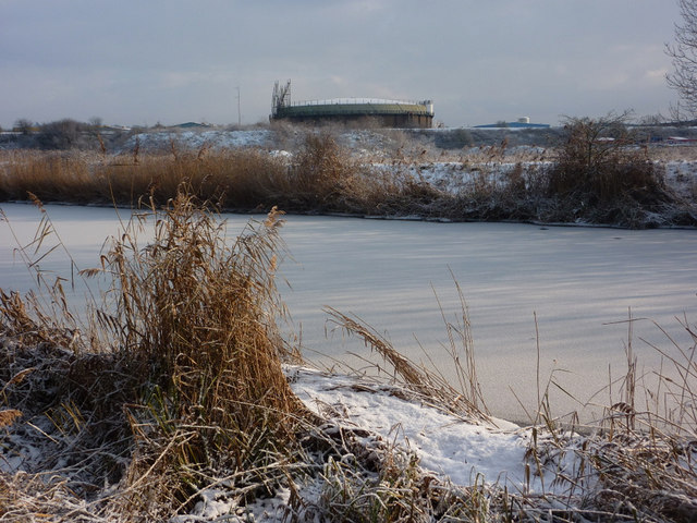
Ice bound River Gipping
Looking across the river from the riverside footpath. The line of the railway embankment can be seen across the picture with the old gasometer beyond.
 Map © Crown Copyright")
TIP: Click the map for more Large scale mapping
- Grid Square
- TM1445, 80 images (more nearby 🔍)
- Photographer
- Andrew Hill (more nearby)
- Date Taken
- Friday, 8 January, 2010 (more nearby)
- Submitted
- Saturday, 9 January, 2010
- Subject Location
-
OSGB36:
 TM 142 451 [100m precision]
WGS84: 52:3.7741N 1:7.4742E - Camera Location
-
OSGB36: TM 142 451
- View Direction
- East-southeast (about 112 degrees)