2005
NS7852 : Field near Cambusnethan House
taken 19 years ago, near to Larkhall, South Lanarkshire, Scotland
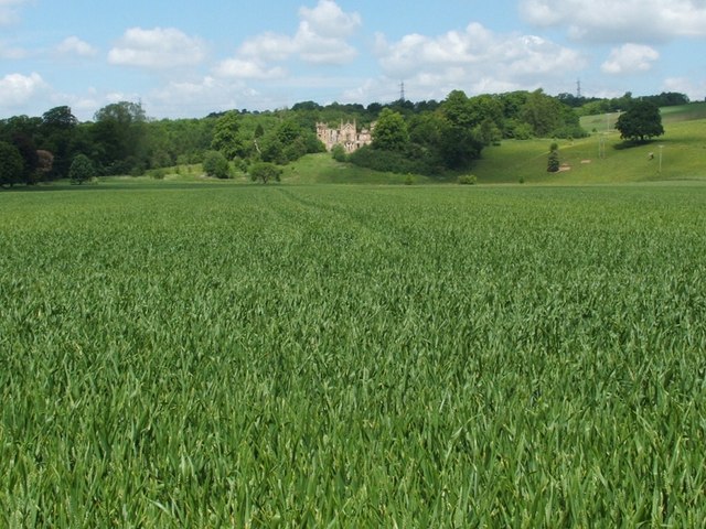
Field near Cambusnethan House
The photograph was taken from the Clyde Walkway, a long-distance footpath that follows the course of the River Clyde.
Visible on the far side of this field of wheat is the ruin of Cambusnethan House (NS7853), a mock priory; see Link (at Historic Environment Scotland) for listed building details, and see the first link in this paragraph for photographs of the building.
Visible on the far side of this field of wheat is the ruin of Cambusnethan House (NS7853), a mock priory; see Link
 Map © Crown Copyright")
TIP: Click the map for more Large scale mapping
- Grid Square
- NS7852, 17 images (more nearby 🔍)
- Photographer
- Lairich Rig (more nearby)
- Date Taken
- Friday, 10 June, 2005 (more nearby)
- Submitted
- Monday, 11 January, 2010
- Subject Location
-
OSGB36:
 NS 7804 5270 [10m precision]
WGS84: 55:45.1351N 3:56.6838W - Camera Location
-
OSGB36: NS 7803 5250
- View Direction
- NORTH (about 0 degrees)