2010
SU9608 : Baycombe Lane Slindon
taken 14 years ago, near to Slindon, West Sussex, England
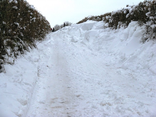
Baycombe Lane Slindon
Normally the road into Slindon from the A29. These deep drifts continued the full length of the lane until its junction with Mill Lane.
 Map © Crown Copyright")
TIP: Click the map for more Large scale mapping
- Grid Square
- SU9608, 192 images (more nearby 🔍)
- Photographer
- Dave Spicer (more nearby)
- Date Taken
- Sunday, 10 January, 2010 (more nearby)
- Submitted
- Wednesday, 13 January, 2010
- Subject Location
-
OSGB36:
 SU 967 085 [100m precision]
WGS84: 50:52.0912N 0:37.5798W - Camera Location
-
OSGB36: SU 968 085
- View Direction
- WEST (about 270 degrees)