2009
ST1133 : Lane to Emble Farm
taken 14 years ago, near to Lydeard st Lawrence, Somerset, England
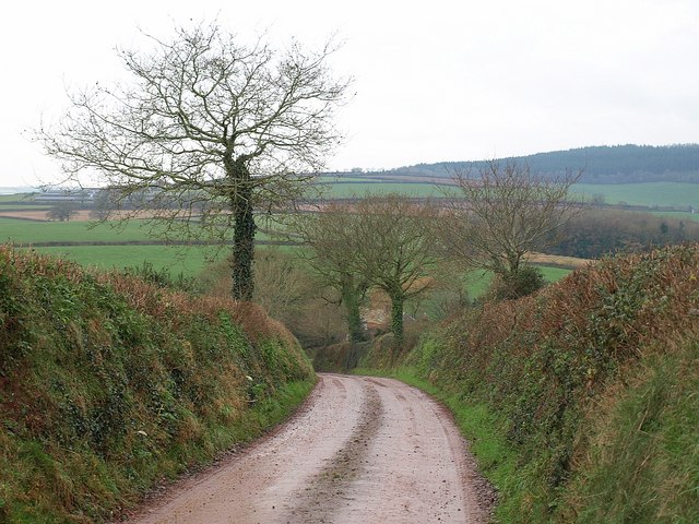
Lane to Emble Farm
Followed by footpath WL22/35 as it drops downhill from the ridge lane near Dean's Cross. The farmhouse can just be discerned behind the laneside oaks.
 Map © Crown Copyright")
TIP: Click the map for more Large scale mapping
- Grid Square
- ST1133, 9 images (more nearby 🔍)
- Photographer
- Derek Harper (more nearby)
- Date Taken
- Monday, 14 December, 2009 (more nearby)
- Submitted
- Thursday, 14 January, 2010
- Subject Location
-
OSGB36:
 ST 1185 3304 [10m precision]
WGS84: 51:5.3924N 3:15.6022W - Camera Location
-
OSGB36: ST 1193 3305
- View Direction
- WEST (about 270 degrees)