NZ2464 : West Walls town wall and ditch
taken 14 years ago, near to Newcastle Upon Tyne, England
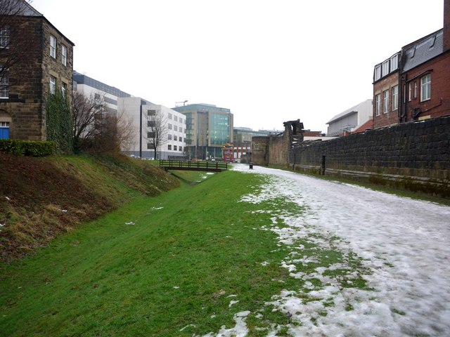
The deep ditch outside the walls NZ2464 : The moat in front of West Walls was added for defensive purposes in about 1312. It was re-excavated and landscaped along this stretch in 1988. The wooden bridge replaces one in this location that was built by the Dominicans from the nearby Friary in 1312.
Tyne and Wear HER (1533): Newcastle town wall, curtain north of Heber Tower Link
The building just visible on the left is the now restored isolation hospital or 'House of Recovery' built in 1804. It was closed in 1888.
Tyne and Wear HER (6293): Newcastle, Bath Lane, Fever Hospital (House of Recovery): Link
St Andrew's Poor House and the Lunatic Asylum, located nearby, have been demolished.
The new developments in the distance are the buildings of Citygate and Gallowgate.
Built in the C13th century to protect the expanding town from Scottish raiders, Newcastles Town Wall was an impressive structure. It was approximately 3km / 2 miles long, up to 2m / 7ft thick and approximately 7.6m / 25ft high. It enclosed the Castle and its Black Gate as well as the main medieval commercial district along the quayside and all the ground northwards to St. Andrews Church. The wall had seven main gateways, 17 towers and 30 turrets. A section of the Wall was extended along the quayside to protect the properties of wealthy merchants from water-borne attack.
Only short sections of the curtain wall now survive as much was demolished in the C19th to aid redevelopment and access. Only five of the original towers have survived.
Wikipedia has a full description and a map Link
Historical Account by Eneas Mackenzie (1827) Link
More images on Geograph can be found with this search Link
National Trails walk around the town walls Link
Tyne and Wear HER(1507): Newcastle town wall Link
 Map © Crown Copyright")
- Grid Square
- NZ2464, 2467 images (more nearby 🔍)
- Photographer
- Andrew Curtis (more nearby)
- Date Taken
- Friday, 15 January, 2010 (more nearby)
- Submitted
- Saturday, 16 January, 2010
- Subject Location
-
OSGB36:
 NZ 2436 6424 [10m precision]
WGS84: 54:58.3312N 1:37.2596W - Camera Location
-
OSGB36: NZ 2435 6420
- View Direction
- North-northeast (about 22 degrees)