1987
TQ8089 : Aerial view of south-west of the Rayleigh Weir
taken 37 years ago, near to Rayleigh, Essex, England
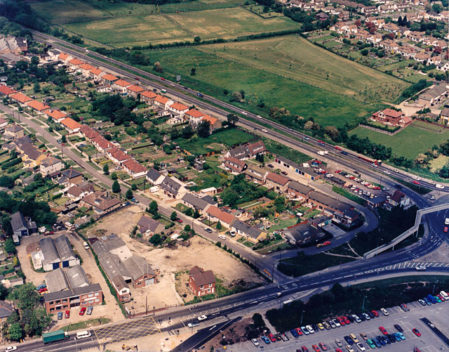
Aerial view of south-west of the Rayleigh Weir
The Rayleigh Weir junction is partially visible at the mid-lower right. The London Arterial Road (A127) runs from the Weir to the upper left, and the Rayleigh Road (A129) to the lower left. The road below and parallel to the A127 is Kingsley Lane. The car park to the lower right is that of Sainsbury's Supermarket. The open area bordering the Rayleigh Road now has several retail and light industrial premises.
 Map © Crown Copyright")
TIP: Click the map for more Large scale mapping
- Grid Square
- TQ8089, 35 images (more nearby 🔍)
- Photographer
- Edward Clack (more nearby)
- Contributed by
- John Rostron (more nearby)
- Date Taken
- Friday, 5 June, 1987 (more nearby)
- Submitted
- Sunday, 17 January, 2010
- Subject Location
-
OSGB36:
 TQ 800 895 [100m precision]
WGS84: 51:34.5686N 0:35.8267E - Camera Location
-
OSGB36: TQ 804 893
- View Direction
- West-northwest (about 292 degrees)